| |
|
Radiation mapping system "RADKAR"
|
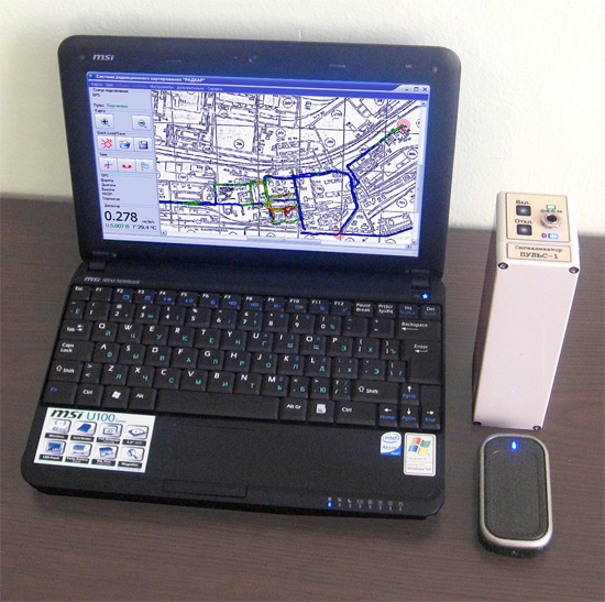
The system is designed for gathering information about the level of terrain gamma radiation and automatically mapping it during vehicular or pedestrian gamma survey.

The system includes:
A dosimeter "Pulse-D" continuously transmitting data over a Bluetooth channel; a laptop or netbook receiving the data from monitoring points within 200 metres; a GPS navigation device; software.
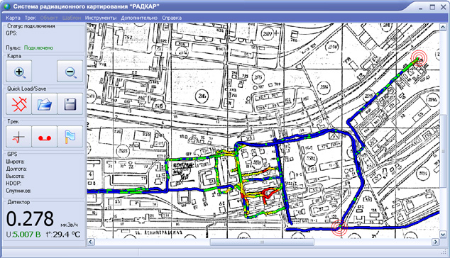
Each component of the system has an independent power supply, which allows to quickly carry out a gamma survey. The mapping software visualises the operation: tracks are mapped as lines the colour whereof depends on the exposure rate measurement in that point. In any point of the track, a "flag" can be set specifying the exposure rate measurement and the name of the point. Parameters monitored during the operation include: temperature, battery voltage, radio reception quality, acceleration. All gamma survey results are saved into an archive and are available at any time.

Installing the radiation mapping system "RADKAR" on reconnaissance robots can be highly advantageous in estimating the significance of a radiation accident and liquidation thereof. Installing "RADKAR" on radio-controlled vehicles (terrestrial or waterborne) allows to carry out mapping of contaminated terrains, minimising the radiation injury fir the personnel.
Technical specifications of the dosimeter "Pulse-D":
• Susceptibility range to gamma radiation: 0.05 - 3.0 MeV;
• Sensitivity: 800 c-1/µSv/h (for Cs137);
• Working range of equivalent dose rate: 10-2...103µSv/h;;
• Maximum permissible measurement error: ±15%;
• Detector material: NaI: diam.30x70 mm;
• Operating temperature range: °C, -30...+50;
• Continuous work time in standby mode with the built-in batteries: 24h;
• Low battery cut-off;
• Overall size, max.: 163x56x44mm;
• Weight, max.: 500g.
|
 |
|
|

|
03680, Ukraine, Kyiv, Palladina Avenue, 34a.
|
|
|
 |
| Director: |
Mr Igor A. Makhnyov |
|
|
|

